|
Study Species / Study Area |
|
Objectives |
|
Preliminary Findings |
|
Conservation Implications |
|
Contact Us |
|
Acknowledgements |
|
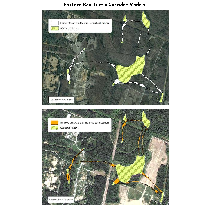
· GIS technologies can
· Compare/contrast the modeled corridors before industrialization and during industrialization on the VAAP site.
· This pilot study within the VAAP study site can subsequently be used to identify linkages between hubs and corridors at a broader scale.
|
|
Click on the following graphics to view presentations relating to |