|
Project Goals
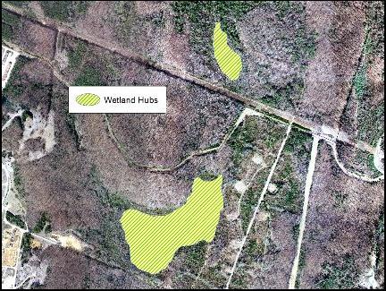
· Can GIS tools be used to extract hubs and model corridors at a fine scale?
Can these two hubs be linked by corridors using factors such as elevation, land cover, slope/aspect, etc.?
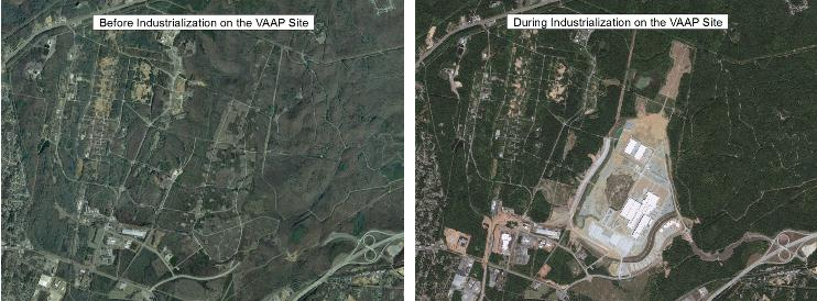
· Compare/contrast the modeled corridors before industrialization and during industrialization on the VAAP site.
As land cover changes on the VAAP site, corridor models for species movement will alter as well.
· Produce a pilot model using GIS technologies that identify linkages between hubs and corridors. · To be applied at a county and/or regional level.
|

|
Study Species / Study Area |
|
Objectives |
|
Preliminary Findings |
|
Conservation Implications |
|
Contact Us |
|
Acknowledgements |